Photo Taken Date: 2013
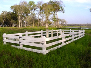
Main Name: Wheat Family Cemetery | FB-C081
Alternate Names:
- Wheat Cemetery
Access: Cemetery access is via PRIVATE property. Permission from the land owner MUST be obtained prior to visiting the cemetery.
Location: Near FM-361, Fairchilds
NAD83 Coordinates: 29 24.949 N, 95 43.212 W
Map Coordinates: 29.41583, -95.72021
Status and Other Information: The cemetery status is inactive. The cemetery is not affiliated with any organizations and the ethnicity is mixed. The size of the cemetery is 0.01 acres. The number of known burials is 7 and the date of the earliest burial is 03/16/1857.
View Wheat Family Cemetery - FB-C081 in a larger map