Photo Taken Date: 2014
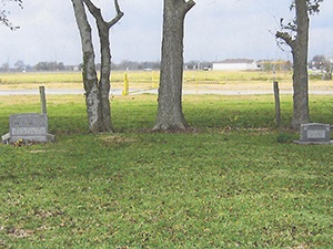
Main Name: Wilderness Branch Baptist Church Cemetery | FB-C136
Alternate Names:
- None
Access: There is public access to the cemetery
Location: 6207 FM 359, Rosenberg
NAD83 Coordinates: : 29 37.794 N, 95 48.446 W
Map Coordinates: : 29.62990, -95.80743
Status and Other Information: The cemetery status is inactive. The cemetery is affiliated with a religious organization and the ethnicity is primarily Anglo. The size of the cemetery is 0.89 acres. The number of known burials is 6 and the date of the earliest burial is 12/12/1863.