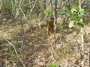
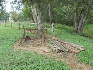
Pleasant Hill Baptist Cemetery

Main Name: Pleasant Hill Missionary Baptist Church Cemetery | FB-C003

Alternate Names:

  • Pleasant Hill Cemetery
  • Pleasant Hill Baptist Cemetery

Access: There is public access to the cemetery.

Location: Bois d’Arc Lane, Fulshear

NAD83 Coordinates: 29 39.332 N, 95 52.987 W

Map Coordinates: 29.655533, -95.883117

Status and Other Information: The cemetery status is active and it has a Historical Marker. The cemetery is affiliated with a religious organization and has no primary ethnicity. The size of the cemetery is 2 acres. The number of known burials is 81 and the date of the earliest burial is 05/19/1935.


View Pleasant Hill Missionary Baptist Church Cemetery - FB-C003 in a larger map


Pleasant Green Missionary Baptist Cemetery | FB-C025

Main Name: Pleasant Green Missionary Baptist Cemetery | FB-C025

Alternate Names:

  • Pleasant Green Cemetery

Access: Public

Location: Madden Road, Clodine

NAD83 Coordinates: 29 39.390 N, 95 42.409 W

Map Coordinates: 29.656500, -95.706817

Status and Other Information: The cemetery status is active.  The cemetery is affiliated with a religious organization and the ethnicity is primarily Afro-American.  The size of the cemetery is 1.91 acres.  The number of known burials is 183 and the date of the earliest burial is 06/10/1914.


View Pleasant Green Missionary Baptist Cemetery - FB-C025 in a larger map


Pleasant Green Cemetery

Main Name: Pleasant Green Missionary Baptist Cemetery | FB-C025

Alternate Names:

  • Pleasant Green Cemetery

Access: Public

Location: Madden Road, Clodine

NAD83 Coordinates: 29 39.390 N, 95 42.409 W

Map Coordinates: 29.656500, -95.706817

Status and Other Information: The cemetery status is active.  The cemetery is affiliated with a religious organization and the ethnicity is primarily Afro-American.  The size of the cemetery is 1.91 acres.  The number of known burials is 183 and the date of the earliest burial is 06/10/1914.


View Pleasant Green Missionary Baptist Cemetery - FB-C025 in a larger map


Plantation Road Cemetery | FB-C107

Photo Taken Date: 2013

Plantation Road Cemetery | FB-C107

Main Name: Plantation Road Cemetery | FB-C107

Alternate Names:

  • Hayes Cemetery
  • Plantation Road Cemetery

Access: Access to the cemetery is via PRIVATE property. Permission from the land owner MUST be obtained prior to visiting the cemetery.

Location: Watts Plantation Rd, Missouri City

NAD83 Coordinates: 29 31.625 N, 95 31.553 W

Map Coordinates: 29.527083, -95.525883

Status and Other Information: The cemetery status is inactive. The cemetery is not affiliated with any organizations and the ethnicity is primarily Afro-American. The size of the cemetery is 0.03 acre. The number of known burials is 7 and the date of the earliest burial is 1905.

View Plantation Road Cemetery | FB-C107 in a larger map

Plantation Road Cemetery

Photo Taken Date: 2013

Plantation Road Cemetery | FB-C107

Main Name: Plantation Road Cemetery | FB-C107

Alternate Names:

  • Hayes Cemetery
  • Plantation Road Cemetery

Access: Access to the cemetery is via PRIVATE property. Permission from the land owner MUST be obtained prior to visiting the cemetery.

Location: Watts Plantation Rd, Missouri City

NAD83 Coordinates: 29 31.625 N, 95 31.553 W

Map Coordinates: 29.527083, -95.525883

Status and Other Information: The cemetery status is inactive. The cemetery is not affiliated with any organizations and the ethnicity is primarily Afro-American. The size of the cemetery is 0.03 acre. The number of known burials is 7 and the date of the earliest burial is 1905.

View Plantation Road Cemetery | FB-C107 in a larger map

Pitts Road Cemetery | FB-C072

Main Name: Pitts Road Cemetery | FB-C072

Alternate Names:

  • None 

Access: Cemetery access is via PRIVATE property. Permission from the land owner MUST be obtained prior to visiting the cemetery.

Location: Pitts Rd, Richmond

NAD83 Coordinates: 29 37.049 N, 95 43.870 W

Map Coordinates: 29.617483, -95.731167

Status and Other Information: The cemetery status is inactive. The cemetery is affiliated with a Private Property - Permission from the land owner MUST be obtained prior to visiting the cemetery. organization and the ethnicity is primarily Afro-American. The size of the cemetery is unknown.


View Pitts Road Cemetery - FB-C072 in a larger map

Pickens Cemetery | FB-C070

Photo Taken Date: 2009

Pickens Cemetery | FB-C070

Main Name: Pickens Cemetery | FB-C070

Alternate Names:

  • Davis Memorial Cemetery

Access: Public

Location: Sharpsburg Dr., Crabb

NAD83 Coordinates: 29 32.583 N, 95 41.040 W

Map Coordinates: 29.543050, -95.684000

Status and Other Information: The cemetery status is inactive. The cemetery is not affiliated with any organizations and the ethnicity is primarily Anglo. The size of the cemetery is 1.0 acre. The number of known burials is 21 and the date of the earliest burial is 1852.


View Pickens Cemetery - FB-C070 in a larger map

Pentecost Graveyard

Photo Taken Date: 2009

 Brown - Beard Cemetery | FB-C068

Main Name: Brown - Beard Cemetery | FB-C068

Alternate Names:

  • Big Creek Cemetery
  • Cummings Road Cemetery
  • Pentecost Graveyard

Access: Cemetery access is via PRIVATE property. Permission from the land owner MUST be obtained prior to visiting the cemetery.

Location: Cummings Road, Damon

NAD83 Coordinates: 29 24.204 N, 95 38.396 W

Map Coordinates: 29.403400, -95.639933

Status and Other Information: The cemetery status is active and it has a Historical Marker. The cemetery is not affiliated with any organizations and the ethnicity is primarily Anglo. The size of the cemetery is 1.32 acres. The number of known burials is 62 and the date of the earliest burial is 09/17/1941.

History: Brown - Beard Cemetery | FB-C068 [PDF]


View Brown - Beard Cemetery - FB-C068 in a larger map

Pena Cemetery

Main Name: Our Lady of Guadalupe Cemetery | FB-C105

Alternate Names:

  • Guadalupe Cemetery
  • Pena Cemetery
  • Latin American Cemetery

Access: Public

Location: Ave D, Rosenberg

NAD83 Coordinates: 29 33.895 N, 95 48.892 W

Map Coordinates: 29.564917, -95.814867

Status and Other Information: The cemetery status is active. The cemetery is affiliated with a religious organization and the ethnicity is mixed. The size of the cemetery is unknown. The number of known burials is 2093 and the date of the earliest burial is 08/05/1924.

View Our Lady of Guadalupe Cemetery | FB-C105 in a larger map

Peaceful Rest Cemetery | FB-C106

Main Name: Peaceful Rest Cemetery | FB-C106

Alternate Names: None

Access: Public

Location: Noble Street, Needville

NAD83 Coordinates: 29 23.774 N, 95 51.037 W

Map Coordinates: 29.396233, -95.850617

Status and Other Information: The cemetery status is active. The cemetery is not affiliated with any organizations and has no primary ethnicity. The size of the cemetery is 1.64 acres. The number of known burials is 255 and the date of the earliest burial is 1961.

View Peaceful Rest Cemetery | FB-C106 in a larger map

Subscribe to Historical Commission