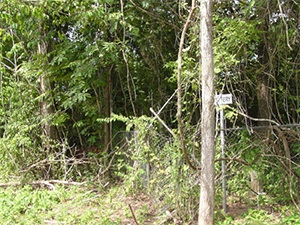
Fort Bend County is experiencing issues with the Public Access Case Search website. The information may take longer than usual to be displayed when looking up case records. The County IT team is working with the vendor to resolve the issues as soon as possible.
Photos Taken Date: 2013
![]() |
![]() |
![]() |
Main Name: Gordon-Taylor Cemetery Cemetery | FB-C142
Alternate Names: Taylor, Gordon Cemetery
Access: There is public access to the cemetery.
Location: George Gordon Road, Fulshear
NAD83 Coordinates: 29 42.836 N, 95 55.722 W
Map Coordinates: 29.71393, -95.92870
Status and Other Information: The cemetery status is active. The cemetery is not affiliated with any organizations and the ethnicity is primarily Afro-American. The size of the cemetery is 0.81 acre. The number of known burials is 3 and the date of the earliest burial is unknown.
History: Work In Progress
Main Name: Glasscock Cemetery | FB-C091
Alternate Names: None
Access: Access to the cemetery is not possible.
Location: In the Brazos River
Coordinates: Not Located
Photo Taken Date: 2013
Main Name: Mt. Olive Baptist Church Cemetery | FB-C094
Alternate Names:
- Gibbs Cemetery
- Grover Cemetery
Access: Cemetery access is via PRIVATE property. Permission from the land owner MUST be obtained prior to visiting the cemetery.
Location: Hagerson Rd, Missouri City
NAD83 Coordinates: 29 32.236 N, 95 34.380 W
Map Coordinates: 29.537267, -95.573000
Status and Other Information: The cemetery status is inactive. The cemetery is affiliated with a religious organization and the ethnicity is primarily Afro-American. The size of the cemetery is 1.13 acres. The number of burials is unknown and the date of the earliest burial is 1989.
View Mt. Olive Baptist Church Cemetery | FB-C094 in a larger map
Main Name: New Hope Cemetery | FB-C023
Alternate Names:
- Gibbs Cemetery
- F.I.S. Cemetery
- Farmers Improvement Society Cemetery
- Stafford Colored Cemetery
- Sand Field Cemetery
Access: Public
Location: Fifth Street, Stafford
NAD83 Coordinates: 29 36.012 N, 95 33.244 W
Map Coordinates: 29.600200, -95.554062
Status and Other Information: The cemetery status is active. The cemetery is not affiliated with any organizations and the ethnicity is primarily Afro-American. The size of the cemetery is unknown. The number of known burials is 347 and the date of the earliest burial is 1910.
View New Hope Cemetery - FB-C023 in a larger map
Main Name: West Gethsemane Cemetery | FB-C028
Alternate Names:
- Gethsemane Cemetery
- Holy Rosary Catholic Cemetery
Access: Public
Location: Hwy 36, Rosenberg
NAD83 Coordinates: 29 32.211 N, 95 48.476 W
Map Coordinates: 29.536850, -95.807933
Status and Other Information: The cemetery status is active. The cemetery is not affiliated with any organizations and the ethnicity is mixed. The size of the cemetery is 2.64 acres. The number of known burials is 809 and the date of the earliest burial is 08/31/1906.
View West Gethsemane Cemetery - FB-C028 in a larger map
Main Name: Trinity Lutheran Church Cemetery | FB-C063
Alternate Names:
- German Lutheran Cemetery
Access: There is public access to the cemetery.
Location: Foster School Road, Beasley
NAD83 Coordinates: 29 27.646 N, 95 51.884 W
Map Coordinates: 29.460767, -95.864733
Status and Other Information: The cemetery status is active. The cemetery is affiliated with a religious organization and the ethnicity is primarily Anglo. The size of the cemetery is 3.0 acres. The number of known burials is 12 and the date of the earliest burial is 1916.
View Trinity Lutheran Church Cemetery - FB-C063Untitled in a larger map
Main Name: Cesinger-Seiler Cemetery | FB-C011
Alternate Names:
- Cesinger Cemetery
- Emmanuel Cemetery
- German Evangelical Cemetery
- Prairie Mound Cemetery
- Seiler Cemetery
Access: Public
Location: Roesler Road, Fairchilds
NAD83 Coordinates: 29 24.643 N, 95 46.795 W
Map Coordinates: 29.410717, -95.779917
History: Cesinger-Seiler Cemetery | FB-C011 [PDF]
Status and Other Information: The cemetery status is active and it has a Historical Marker. The cemetery is not affiliated with any organizations and the ethnicity is primarily Anglo. The size of the cemetery is 0.96 acres. The number of known burials is 65 and the date of the earliest burial is 10/16/1894.
View Cesinger-Seiler Cemetery - FB-C011 in a larger map

Photo Date: 2013
Main Name: Needville Baptist Church Cemetery | FB-C009
Alternate Names:
- Dipple Cemetery
- Fink Baptist Cemetery
- First Baptist Church Cemetery
- German Baptist Cemetery
- Maden Cemetery
- Maiden Cemetery
- Needville Baptist Cemetery
- Salem Baptist Cemetery
Access: Public
Location: FM-1236, Needville
NAD83 Coordinates: 29 23.130 N, 95 51.054 W
Map Coordinates: 29.385500, -95.850900
Status and Other Information: The cemetery status is active. The cemetery is affiliated with a religious organization and the ethnicity is primarily Anglo. The size of the cemetery is unknown. The number of known burials is 25 and the date of the earliest burial is 08/12/1899.
View Needville Baptist Church Cemetery - FB-C009 in a larger map
Main Name: Jones Memorial Cemetery, Henry & Nancy Stiles | FB-C035
Alternate Names:
- George Ranch Cemetery
- Henry Jones Cemetery
- Jones Cemetery
Access: Cemetery access is via PRIVATE property. Permission from the land owner MUST be obtained prior to visiting the cemetery.
Location: George Road, Crabb
NAD83 Coordinates: 29 29.871 N, 95 40.917 W
Map Coordinates: 29.497850, -95.681950
Status and Other Information: The cemetery status is inactive. The cemetery is not affiliated with any organizations and the ethnicity is mixed. The size of the cemetery is 0.20 acre.
View Jones Memorial Cemetery, Henry & Nancy Stiles - FB-C035 in a larger map
Main Name: Gaston Cemetery | FB-C059
Alternate Names:
- Old Jones Cemetery
Access: Cemetery access is via PRIVATE property. Permission from the land owner MUST be obtained prior to visiting the cemetery.
Location: Briscoe Road, Rosenberg
NAD83 Coordinates: 29 40.817 N, 95 46.482 W
Map Coordinates: 29.680250, -95.791367
Status and Other Information: The cemetery status is inactive. The cemetery is not affiliated with any organizations and the ethnicity is primarily Anglo. The size of the cemetery is 0.1 acre. The number of known burials is 12 and the date of the earliest burial is 05/05/1903.
View Gaston Cemetery - FB-C059 in a larger map