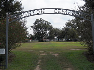
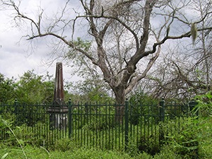
Salem Baptist Cemetery
Needville Baptist Church Cemetery | FB-C009

Photo Date: 2013

Main Name: Needville Baptist Church Cemetery | FB-C009

Alternate Names:

  • Dipple Cemetery
  • Fink Baptist Cemetery
  • First Baptist Church Cemetery
  • German Baptist Cemetery
  • Maden Cemetery
  • Maiden Cemetery
  • Needville Baptist Cemetery
  • Salem Baptist Cemetery

Access: Public

Location: FM-1236, Needville

NAD83 Coordinates: 29 23.130 N, 95 51.054 W

Map Coordinates: 29.385500, -95.850900

Status and Other Information: The cemetery status is active. The cemetery is affiliated with a religious organization and the ethnicity is primarily Anglo. The size of the cemetery is unknown. The number of known burials is 25 and the date of the earliest burial is 08/12/1899.


View Needville Baptist Church Cemetery - FB-C009 in a larger map


Saint Gabriel Cemetery

Main Name: San Gabriel Cemetery | FB-C030

Alternate Names:

  • Saint Gabriel Cemetery

Access: Public

Location: Ransom Road, Richmond

NAD83 Coordinates: 29 34.506 N, 95 45.290 W

Map Coordinates: 29.575100, -95.754833

Status and Other Information: The cemetery status is active.  The cemetery is not affiliated with any organizations and the ethnicity is mixed.  The size of the cemetery is 3.89 acres.  The number of known burials is 1729 and the date of the earliest burial is 01/29/1911.


View San Gabriel Cemetery - FB-C030 in a larger map


Routt Point Cemetery | FB-C004

Main Name: Routt Point Cemetery | FB-C004

Alternate Name: Watson Cemetery

Access: Public

Location: Moody Road, Needville

NAD83 Coordinates: 29 21.117 N, 95 54.695 W

Map Coordinates: 29.351950, -95.911583

Status and Other Information: The cemetery status is active. The cemetery is not affiliated with any organizations and the ethnicity is primarily Afro-American. The size of the cemetery is 1.0 acre. The number of known burials is 131 and the date of the earliest burial is 12/11/1941. 


View Routt Point Cemetery - FB-C004 in a larger map


Routt Family Cemetery | FB-C114

Main Name: Routt Family Cemetery | FB-C114

Alternate Name: None

Access: Access to the cemetery is via PRIVATE property. Permission from the land owner MUST be obtained prior to visiting the cemetery.

Location: Moody Road, Needville

NAD83 Coordinates: 28 53.772 N, 95 55.349 W

Map Coordinates: 29.345117, -95.925817

Status and Other Information: The cemetery status is inactive. The cemetery is not affiliated with any organizations and the ethnicity is primarily Afro-American. The size of the cemetery is 0.04 acre. The number of known burials is 14 and the date of the earliest burial is 1925.


View Routt Family Cemetery | FB-C114 in a larger map

Rosenberg City Cemetery | FB-C002

Main Name: Rosenberg City Cemetery | FB-C002

Alternate Names:

  • W.O.W. Cemetery
  • Woodman of the World Cemetery

Access: There is public access to the cemetery.

Location: Ave D, Rosenberg

NAD83 Coordinates: 29 33.819 N, 95 48.822 W

Map Coordinates: 29.563649, -95.813702

Status and Other Information: The cemetery status is active and it has a Historical Marker. The cemetery is not affiliated with any organizations and the ethnicity is mixed. The size of the cemetery is 9.45 acres. The number of known burials is 3,041 and the date of the earliest burial is 09/12/1910.


View Rosenberg City Cemetery - FB-C002 in a larger map


Rosenberg City Cemetery

Main Name: Community Cemetery, Rosenberg | FB-C052

Alternate Names:

  • Bird Cemetery
  • Byrd Cemetery
  • Rosenberg Cemetery
  • Rosenberg City Cemetery

Access: Public

Location: 310 Blume Road, Rosenberg

NAD83 Coordinates: 29 32.342 N, 95 49.604 W

Map Coordinates: 29.539033, -95.826733

Status and Other Information: The cemetery status is active.  The cemetery is not affiliated with any organizations and the ethnicity is primarily Afro-American.  The size of the cemetery is 2.0 acres.  The number of known burials is 209 and the date of the earliest burial is 02/16/1927.


View Community Cemetery, Rosenberg - FB-C052 in a larger map


Rosenberg Cemetery

Main Name: Community Cemetery, Rosenberg | FB-C052

Alternate Names:

  • Bird Cemetery
  • Byrd Cemetery
  • Rosenberg Cemetery
  • Rosenberg City Cemetery

Access: Public

Location: 310 Blume Road, Rosenberg

NAD83 Coordinates: 29 32.342 N, 95 49.604 W

Map Coordinates: 29.539033, -95.826733

Status and Other Information: The cemetery status is active.  The cemetery is not affiliated with any organizations and the ethnicity is primarily Afro-American.  The size of the cemetery is 2.0 acres.  The number of known burials is 209 and the date of the earliest burial is 02/16/1927.


View Community Cemetery, Rosenberg - FB-C052 in a larger map


Roberson-Chappel Cemetery

Main Name: Bland Cemetery | FB-C113

Alternate Names:

  • Roberson Cemeterty
  • Roberson-Chappel Cemetery

Access: Access to the cemetery is via PRIVATE property. Permission from the land owner MUST be obtained prior to visiting the cemetery.

Location: Near Clay Rd, Richmond

NAD83 Coordinates: 29 35.649 N, 95 45.568 W

Map Coordinates: 29.594150, -95.759467

Status and Other Information: The cemetery status is inactive. The cemetery is not affiliated with any organizations and the ethnicity is primarily Afro-American. The size of the cemetery is unknown. The number of known burials is 2 and the date of the earliest burial is 12/29/1892.

View Bland Cemetery | FB-C113 in a larger map

Roberson Cemetery

Main Name: Bland Cemetery | FB-C113

Alternate Names:

  • Roberson Cemeterty
  • Roberson-Chappel Cemetery

Access: Access to the cemetery is via PRIVATE property. Permission from the land owner MUST be obtained prior to visiting the cemetery.

Location: Near Clay Rd, Richmond

NAD83 Coordinates: 29 35.649 N, 95 45.568 W

Map Coordinates: 29.594150, -95.759467

Status and Other Information: The cemetery status is inactive. The cemetery is not affiliated with any organizations and the ethnicity is primarily Afro-American. The size of the cemetery is unknown. The number of known burials is 2 and the date of the earliest burial is 12/29/1892.

View Bland Cemetery | FB-C113 in a larger map

Roan – Mayshack Cemetery | FB-C089

Main Name: Roan – Mayshack Cemetery | FB-C089

Alternate Names: None

Access: Cemetery access is via PRIVATE property. Permission from the land owner MUST be obtained prior to visiting the cemetery.

Location: Near SH-36, Rosenberg

NAD83 Coordinates: 29 33.852 N, 95 50.297 W

Map Coordinates: 29.564200, -95.838283

Status and Other Information: The cemetery status is inactive. The cemetery is not affiliated with any organizations and the ethnicity is primarily Afro-American. The size of the cemetery is unknown. The number of known burials is 5 and the date of the earliest burial is 02/12/1917.


View Roan – Mayshack Cemetery | FB-C089 in a larger map

Subscribe to Historical Commission