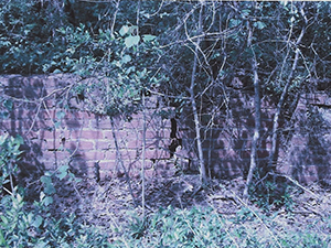
New Prospect Cemetery

Main Name: New Prospect Baptist Church Cemetery | FB-C054

Alternate Names:

  • Armstrong Cemetery
  • New Prospect Cemetery
  • Prospect Baptist Church Cemetery

Access: Public

Location: FM 442, Needville

NAD83 Coordinates: 29 20.277 N, 95 51.405 W

Map Coordinates: 29.337950, -95.856750

Status and Other Information: The cemetery status is active.  The cemetery is affiliated with a religious organization and the ethnicity is primarily Afro-American.  The size of the cemetery is 1.08 acres.  The number of known burials is 165 and the date of the earliest burial is 04/04/1916.


View New Prospect Baptist Church Cemetery - FB-C054 in a larger map


New Prospect Baptist Church Cemetery | FB-C054

Main Name: New Prospect Baptist Church Cemetery | FB-C054

Alternate Names:

  • Armstrong Cemetery
  • New Prospect Cemetery
  • Prospect Baptist Church Cemetery

Access: Public

Location: FM 442, Needville

NAD83 Coordinates: 29 20.277 N, 95 51.405 W

Map Coordinates: 29.337950, -95.856750

Status and Other Information: The cemetery status is active.  The cemetery is affiliated with a religious organization and the ethnicity is primarily Afro-American.  The size of the cemetery is 1.08 acres.  The number of known burials is 165 and the date of the earliest burial is 04/04/1916.


View New Prospect Baptist Church Cemetery - FB-C054 in a larger map


New Hope Cemetery | FB-C023

Main Name: New Hope Cemetery | FB-C023

Alternate Names:

  • Gibbs Cemetery
  • F.I.S. Cemetery
  • Farmers Improvement Society Cemetery
  • Stafford Colored Cemetery
  • Sand Field Cemetery

Access: Public

Location: Fifth Street, Stafford

NAD83 Coordinates: 29 36.012 N, 95 33.244 W

Map Coordinates: 29.600200, -95.554062

Status and Other Information: The cemetery status is active.  The cemetery is not affiliated with any organizations and the ethnicity is primarily Afro-American.  The size of the cemetery is unknown.  The number of known burials is 347 and the date of the earliest burial is 1910.


View New Hope Cemetery - FB-C023 in a larger map


New Home Missionary Baptist Cemetery | FB-C016

Main Name: New Home Missionary Baptist Cemetery | FB-C016

Alternate Name: New Home Cemetery

Access: Public

Location: Orchard Lakes Estate Drive, Clodine

NAD83 Coordinates: 29 37.495 N, 95 40.993 W

Map Coordinates: 29.624917, -95.683217

Status and Other Information: The cemetery status is active. The cemetery is affiliated with a religious organization and the ethnicity is primarily Afro-American. The size of the cemetery is 2.34 acres. The number of known burials is 39 and the date of the earliest burial is 10/15/1929.


View New Home Missionary Baptist Cemetery - FB-C016 in a larger map


New Home Cemetery

Main Name: New Home Missionary Baptist Cemetery | FB-C016

Alternate Name: New Home Cemetery

Access: Public

Location: Orchard Lakes Estate Drive, Clodine

NAD83 Coordinates: 29 37.495 N, 95 40.993 W

Map Coordinates: 29.624917, -95.683217

Status and Other Information: The cemetery status is active. The cemetery is affiliated with a religious organization and the ethnicity is primarily Afro-American. The size of the cemetery is 2.34 acres. The number of known burials is 39 and the date of the earliest burial is 10/15/1929.


View New Home Missionary Baptist Cemetery - FB-C016 in a larger map


New Fairchild Cemetery | FB-C153

Photo Taken Date:2012

New Fairchild Cemetery

Main Name: New Fairchild Cemetery | FB-C153

Alternate Names:

  • None

Access: Cemetery access is via PRIVATE property. Permission from the land owner MUST be obtained prior to visiting the cemetery.

Location: Fairchilds Rd, Fairchilds

NAD83 Coordinates: Latitude: 29 26.807 N, Longitude: 95 45.722 W

Map Coordinates: 29.44678,-95.76204

Status and Other Information: The cemetery status is inactive. The cemetery is not affiliated with any organizations and has no primary ethnicity. The size of the cemetery is unknown. The number of burials is unknown and the date of the earliest burial is 2005.

History: Work In Progress

New Addition Cemetery

Photo Taken Date: 2017

Imperial Farm Cemetery | FB-C121

Main Name: Imperial Farm Cemetery | FB-C121

Alternate Names:

  • Central Unit Cemetery
  • New Addition Cemetery
  • Old Imperial Farm Cemetery
  • State Prison Cemetery
  • Sugar Land Cemetery
  • TDJC Central Unit Cemetery

Access: Cemetery access is via PRIVATE property. Permission from the land owner MUST be obtained prior to visiting the cemetery.

Location: Near Hwy6 and SH-90A, Sugar Land

NAD83 Coordinates: 29 36.314 N, 95 39.440 W

Map Coordinates: 29.605233, -95.657333

Status and Other Information: The cemetery status is inactive and it has a Historical Marker. The cemetery is not affiliated with any organizations and the ethnicity is mixed. The size of the cemetery is unknown. The number of known burials is 35 and the date of the earliest burial is 02/10/1912.

View Imperial Farm Cemetery | FB-C121 in a larger map

Needville Public Cemetery | FB-C061

Main Name: Needville Public Cemetery | FB-C061

Alternate Names: Bode Cemetery

Access: There is public access to the cemetery.

Location: Needville-Fairchilds Rd, Needville

NAD83 Coordinates: 29 24.057 N, 95 48.829 W

Map Coordinates: 29.40095, -95.81382

Status and Other Information: The cemetery status is active. The cemetery is not affiliated with any organizations and the ethnicity is primarily Anglo. The size of the cemetery is unknown. The number of known burials is 936 and the date of the earliest burial is 09/01/1897.


View Needville Public Cemetery - FB-C061 in a larger map

Needville Methodist Church Cemetery | FB-C151

 Photos Taken Date: 2015

Needville Methodist Church Cemetery | FB-C151 Needville Methodist Church Cemetery | FB-C151
 

Main Name: Needville Methodist Church Cemetery | FB-C151

Alternate Names:

  • Zich Cemetery
  • Needville German Methodist Cemetery

Access:There is public access to the cemetery.

Location: Needville-Fairchilds Rd, Needville

NAD83 Coordinates: 29° 24.052 N, 95° 48.831 W

Map Coordinates: 29.40097, -95.81385

Status and Other Information: The cemetery status is active and has a Historical Marker. The cemetery is affiliated with a religious organization and the ethnicity is primarily Anglo. The size of the cemetery is unknown. The number of known burials is 18 and the date of the earliest burial is 12/13/1903.

History: Work In Progress

Needville German Methodist Cemetery

 Photos Taken Date: 2015

Needville Methodist Church Cemetery | FB-C151 Needville Methodist Church Cemetery | FB-C151
 

Main Name: Needville Methodist Church Cemetery | FB-C151

Alternate Names:

  • Zich Cemetery
  • Needville German Methodist Cemetery

Access:There is public access to the cemetery.

Location: Needville-Fairchilds Rd, Needville

NAD83 Coordinates: 29° 24.052 N, 95° 48.831 W

Map Coordinates: 29.40097, -95.81385

Status and Other Information: The cemetery status is active and has a Historical Marker. The cemetery is affiliated with a religious organization and the ethnicity is primarily Anglo. The size of the cemetery is unknown. The number of known burials is 18 and the date of the earliest burial is 12/13/1903.

History: Work In Progress

Subscribe to Historical Commission