Barnett Cemetery | FB-C067

Main Name: Barnett Cemetery | FB-C067

Alternate Names:

  • None

Access: Cemetery access is via PRIVATE property. Permission from the land owner MUST be obtained prior to visiting the cemetery.

Location: Near Hwy 36 west of Rosenberg

NAD83 Coordinates: 29 35.175 N, 95 53.208 W

Map Coordinates: 29.586250, -95.886800

Status and Other Information: The cemetery status is inactive. The cemetery is not affiliated with any organizations and the ethnicity is primarily Anglo. The size of the cemetery is 0.04 acres. The number of known burials is 20 and the date of the earliest burial is 01/11/1834.


View Barnett Cemetery - FB-C067 in a larger map

Baptist Hill Cemetery

Main Name: Thomas Cemetery, Faithe | FB-C076

Alternate Names:

  • Baptist Hill Cemetery
  • Brown Cemetery
  • Dave Fields Cemetery
  • Fate Thomas Cemetery
  • Fayette Thomas Cemetery
  • Fields Cemetery

Access: Public

Location: Collins Rd, Richmond

NAD83 Coordinates: 29 35.235 N, 95 46.325 W

Map Coordinates: 29.587250, -95.772083


View Thomas Cemetery, Faithe - FB-C076 in a larger map

Baptist Cemetery

Photo Taken Date: 2009
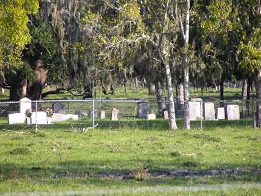
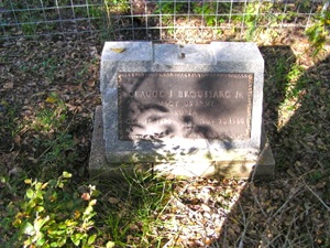
Mt. Pilgrim Baptist Church | FB-C095

Main Name: Mt. Pilgrim Baptist Church Cemetery | FB-C095

Alternate Names:

  • Baptist Cemetery
  • Mt. Pilgrim Cemetery

Access: Public

Location: FM 2759, Thompsons

NAD83 Coordinates: 29 29.888 N, 95 35.500 W

Map Coordinates: 29.498133, -95.591667

Status and Other Information: The cemetery status is active. The cemetery is affiliated with a religious organization and the ethnicity is primarily Afro-American. The size of the cemetery is 1.76 acres. The number of known burials is 99 and the date of the earliest burial is 06/06/1906.

View Mt. Pilgrim Baptist Church Cemetery | FB-C095 in a larger map

Baptist Cemetery

Main Name: Newman Chapel Cemetery | FB-C048

Alternate Names:

  • Baptist Cemetery
  • Methodist Episcopal Cemetery
  • Old Kendleton Cemetery

Access: Public

Location: Allen Bates Park, Kendleton

NAD83 Coordinates: 29 26.031 N, 96 00.334 W

Map Coordinates: 29.433850, -96.005567

Status and Other Information: The cemetery status is inactive.  The cemetery is affiliated with a religious organization and the ethnicity is primarily Afro-American.  The size of the cemetery is 0.75 acre.  The number of known burials is 18 and the date of the earliest burial is 05/13/1882.


View Newman Chapel Cemetery - FB-C048 in a larger map


Baker Cemetery

Main Name: Modena Cemetery | FB-C005

Alternate Names:

  • Baker Cemetery
  • Hope Lutheran Cemetery
  • Modena Hope Lutheran Cemetery

Access: Public

Location: Baker Road, Beasley

NAD83 Coordinates: 29 28.238 N, 95 53.936 W

Map Coordinates: 29.470633, -95.898933

Status and Other Information: The cemetery status is active. The cemetery is not affiliated with any organizations and the ethnicity is primarily Anglo. The size of the cemetery is 1.96 acres. The number of known burials is 209 and the date of the earliest burial is 06/17/1894.


View Modena Cemetery - FB-C005 in a larger map


Bains Cemetery

Photo Taken Date: 2011

Bains Family Cemetery | FB-C032

Main Name: Bains Family Cemetery | FB-C032

Alternate Names:

  • Bains Cemetery

Access: Cemetery access is via PRIVATE property. Permission from the land owner MUST be obtained prior to visiting the cemetery.

Location: Near Wallis St., Fulshear

NAD83 Coordinates: 29 41.715 N, 95 54.427 W

Map Coordinates: 29.695250, -95.907117

Status and Other Information: The cemetery status is inactive. The cemetery is not affiliated with any organizations and has no primary ethnicity. The size of the cemetery is 0.02 acres. The number of known burials is 8 and the date of the earliest burial is 11/24/1867.


View Bains Family Cemetery - FB-C032 in a larger map


Armstrong Family Cemetery | FB-C145

Photo Taken Date: 2015

Armstrong Family Cemetery | FB-C145

Main Name: Armstrong Family Cemetery | FB-C145

Alternate Names:

  • None

Access:Cemetery access is via PRIVATE property. Permission from the land owner MUST be obtained prior to visiting the cemetery.

Location: Shenley Road, Guy

NAD83 Coordinates: 29 17.722 , 95 49.156 W

Map Coordinates: 29.29392, -95.82075

Status and Other Information: The cemetery status is inactive.

History: Work In Progress.


Armstrong Cemetery

Main Name: New Prospect Baptist Church Cemetery | FB-C054

Alternate Names:

  • Armstrong Cemetery
  • New Prospect Cemetery
  • Prospect Baptist Church Cemetery

Access: Public

Location: FM 442, Needville

NAD83 Coordinates: 29 20.277 N, 95 51.405 W

Map Coordinates: 29.337950, -95.856750

Status and Other Information: The cemetery status is active.  The cemetery is affiliated with a religious organization and the ethnicity is primarily Afro-American.  The size of the cemetery is 1.08 acres.  The number of known burials is 165 and the date of the earliest burial is 04/04/1916.


View New Prospect Baptist Church Cemetery - FB-C054 in a larger map


Arcola-Fresno Cemetery | FB-C047

Main Name: Arcola-Fresno Cemetery | FB-C047

Alternate Names:

  • Fresno Cemetery
  • Riceton-Arcola Cemetery

Access: Public

Location: Rabb/Burford Road, Fresno

NAD83 Coordinates: 29 31.489 N, 95 27.217 W

Map Coordinates: 29.524817, -95.453617

Status and Other Information: The cemetery status is active. The cemetery is not affiliated with any organizations and the ethnicity is mixed. The size of the cemetery is 1.54 acres. The number of known burials is 234 and the date of the earliest burial is 07/04/1853.


View Arcola-Fresno Cemetery - FB-C047 in a larger map


Arcola Community Cemetery

Main Name: Community Cemetery, Arcola | FB-C057

Alternate Names:

  • Arcola Community Cemetery
  • Sienna Plantation Cemetery

Access: Cemetery access is via PRIVATE property.  Permission from the land owner MUST be obtained prior to visiting the cemetery.

Location: Near Scanlan Rd, Arcola

NAD83 Coordinates: 29 28.687 N, 95 29.182 W

Map Coordinates: 29.478117, -95.486367

Status and Other Information: The cemetery status is inactive.  The cemetery is affiliated with a religious organization and has no primary ethnicity.  The size of the cemetery is 1.75 acres.  The number of known burials is 3 and the date of the earliest burial is 1921.


View Community Cemetery, Arcola - FB-C057 in a larger map


Subscribe to Historical Commission