Photo Taken Date: 2013
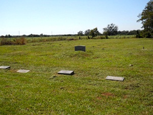
Main Name: Grand Central Cemetery | FB-C083
Alternate Names:
- None
Access: Public
Location: Old Bridge Street, Sugar Land
NAD83 Coordinates: 29 36.300 N, 95 36.151 W
Map Coordinates: 29.605000, -95.602517
Status and Other Information: The cemetery status is inactive. The cemetery is not affiliated with any organizations and the ethnicity is mixed. The size of the cemetery is 1.21 acres. The number of known burials is 258 and the date of the earliest burial is unknown.
View Grand Central Cemetery - FB-C083 in a larger map