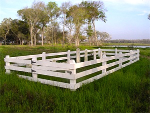
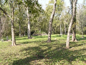
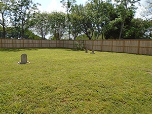
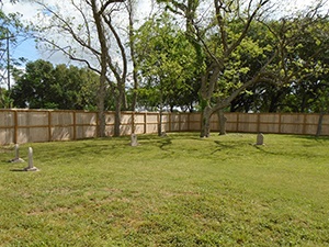
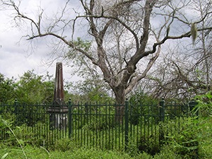
Watts Cemetery | FB-C130

Photo Taken  Date:2010

Main Name: Watts Cemetery | FB-C130Watts Cemetery

Alternate Name: Watts Plantation Cemetery

Access: Public

Location: Watts Plantation Rd, Missouri City

NAD83 Coordinates: 29 31.598 N, Longitude: 95 30.949 W

Map Coordinates: 29.52663,-95.51582

Status and Other Information: The cemetery status is active. The cemetery is not affiliated with any organizations and has no primary ethnicity. The size of the cemetery is unknown. The number of known burials is 66 and the date of the earliest burial is 01/28/1862.


View Watts - FB-C130 in a larger map


Watson Cemetery

Main Name: Routt Point Cemetery | FB-C004

Alternate Name: Watson Cemetery

Access: Public

Location: Moody Road, Needville

NAD83 Coordinates: 29 21.117 N, 95 54.695 W

Map Coordinates: 29.351950, -95.911583

Status and Other Information: The cemetery status is active. The cemetery is not affiliated with any organizations and the ethnicity is primarily Afro-American. The size of the cemetery is 1.0 acre. The number of known burials is 131 and the date of the earliest burial is 12/11/1941.


View Routt Point Cemetery - FB-C004 in a larger map


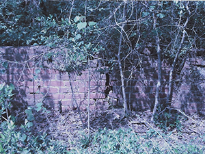
Watkins Cemetery - FB-C129

 Photos Taken Date: 2016

Watkins Cemetery Watkins Cemetery
 

Main Name: Watkins Cemetery | FB-C129

Alternate Names: None

Access: There is public access to the cemetery.

Location: Grand Parkway 99, Sugar Land

NAD83 Coordinates: 29 35.162 N, 95 40.690 W

Map Coordinates: 29.58603, -95.67817

Status and Other Information: The cemetery status is inactive. The cemetery is not affiliated with any organizations and has no primary ethnicity. The size of the cemetery is 0.02 acres. The number of known burials is 8 and the date of the earliest burial is 11/24/1867.

Waters Plantation Cemetery | FB-C128

Photo Taken Date: 2008

Waters Plantation Cemetery | FB-C128

Main Name: Waters Plantation Cemetery | FB-C128

Alternate Names:

  • Sienna Plantation Cemetery
  • Waters Cemetery


Access: Cemetery access is via PRIVATE property. Permission from the land owner MUST be obtained prior to visiting the cemetery.

Location: On Sienna Plantation, Sugar Land

NAD83 Coordinates: 29 29.888 N, 95 33.137 W

Map Coordinates: 29.49814, -95.55229

Status and Other Information: The cemetery status is inactive. The cemetery is not affiliated with any organizations and the ethnicity is primarily Anglo. The size of the cemetery is 0.04 acre. The number of known burials is 6 and the date of the earliest burial is 07/30/1844.

Waters Cemetery

Photo Taken Date: 2008

Waters Plantation Cemetery | FB-C128

Main Name: Waters Plantation Cemetery | FB-C128

Alternate Names:

  • Sienna Plantation Cemetery
  • Waters Cemetery


Access: Cemetery access is via PRIVATE property. Permission from the land owner MUST be obtained prior to visiting the cemetery.

Location: On Sienna Plantation, Sugar Land

NAD83 Coordinates: 29 29.888 N, 95 33.137 W

Map Coordinates: 29.49814, -95.55229

Status and Other Information: The cemetery status is inactive. The cemetery is not affiliated with any organizations and the ethnicity is primarily Anglo. The size of the cemetery is 0.04 acre. The number of known burials is 6 and the date of the earliest burial is 07/30/1844.

Washington Cemetery | FB-C127

Photo Taken Date: 2011

Washington Cemetery

Main Name: Washington Cemetery | FB-C0127

Alternate Names:

  • None

Access: There is public access to the cemetery..

Location: Rolling Oaks Subdivision, W. Deer Wood, Richmond

NAD83 Coordinates: Latitude: 29 40.117 N, Longitude: 95 48.606 W

Map Coordinates: 29.66861,-95.81010

Status and Other Information: The cemetery status is inactive. The cemetery is not affiliated with any organizations and the ethnicity is primarily Anglo. The size of the cemetery is 1.3 acres. The number of known burials is 5 and the date of the earliest burial is 09/01/1909.

Wallis Road Cemetery | FB-C133

Photo Taken Date: 2013

Wallis Road Cemetery | FB-C133

Main Name: Wallis Road Cemetery | FB-C133

Alternate Names: None

    Access: Cemetery access is via PRIVATE property. Permission from the land owner MUST be obtained prior to visiting the cemetery.

    Location: FM-1952, Orchard

    NAD83 Coordinates: Latitude: 29 34.419 N, Longitude: 96 00.236 W

    Map Coordinates: 29.57365, -96.00393

    Status and Other Information: The cemetery status is inactive. The cemetery is not affiliated with any organizations and has no primary ethnicity. The size of the cemetery is 0.03 acre. The number of known burials is 1 and the date of the burial is unknown.

    Walker Family Cemetery | FB-C126

    Photo Taken Date: Unknown

    Walker Family Cemetery | FB-C126

    Main Name: Walker Family Cemetery | FB-C126


    Alternate Names:

    • Walker Cemetery

    Access: Cemetery access is via PRIVATE property. Permission from the land owner MUST be obtained prior to visiting the cemetery.

    Location: Bois d’ Arc Lane, Fulshear

    NAD83 Coordinates: 29 40.873 N, 95 53.243 W

    Map Coordinates: 29.68121, -95.88738

    Status and Other Information: The cemetery status is inactive. The cemetery is not affiliated with any organizations and has no primary ethnicity. The size of the cemetery is 0.07 acre. The number of known burials is 13 and the date of the earliest burial is 09/16/1867.

    Walker Cemetery

    Photo Taken Date: Unknown

    Walker Family Cemetery | FB-C126

    Main Name: Walker Family Cemetery | FB-C126


    Alternate Names:

    • Walker Cemetery

    Access: Cemetery access is via PRIVATE property. Permission from the land owner MUST be obtained prior to visiting the cemetery.

    Location: Bois d’ Arc Lane, Fulshear

    NAD83 Coordinates: 29 40.873 N, 95 53.243 W

    Map Coordinates: 29.68121, -95.88738

    Status and Other Information: The cemetery status is inactive. The cemetery is not affiliated with any organizations and has no primary ethnicity. The size of the cemetery is 0.07 acre. The number of known burials is 13 and the date of the earliest burial is 09/16/1867.

    W.O.W. Cemetery

    Main Name: Rosenberg City Cemetery | FB-C002

    Alternate Names:

    • W.O.W. Cemetery
    • Woodman of the World Cemetery

    Access: There is public access to the cemetery.

    Location: Ave D, Rosenberg

    NAD83 Coordinates: 29 33.819 N, 95 48.822 W

    Map Coordinates: 29.563649, -95.813702

    Status and Other Information: The cemetery status is active and it has a Historical Marker. The cemetery is not affiliated with any organizations and the ethnicity is mixed. The size of the cemetery is 9.45 acres. The number of known burials is 3,041 and the date of the earliest burial is 09/12/1910.


    View Rosenberg City Cemetery - FB-C002 in a larger map


    Subscribe to Historical Commission