--
Days
--
Hours
--
Minutes
--
Seconds
Countdown to July 4, 2026
Countdown to July 4, 2026
Countdown to July 4, 2026
The Fort Bend County Historical Commission will host "Turning 250: Fort Bend County celebrates the American Journey on Saturday, Nov. 21, 2026. Step into history and celebrate 250 years of America at this free event at the Fort Bend Museum from 9 AM to 4 PM. It will feature local museums and cultural organizations, historical re-enactors portraying figures such as Thomas Jefferson and Davy Crockett, musical and dance performances, hands-on activities and much more! "Turning 250" will take place just down the street from the annual Pecan Harvest Festival, giving visitors the opportunity to enjoy both events and experience a full day of history, culture, and family-friendly fun in historic Richmond. Read more
Welcome to Fort Bend County’s Celebration of America’s 250th Anniversary
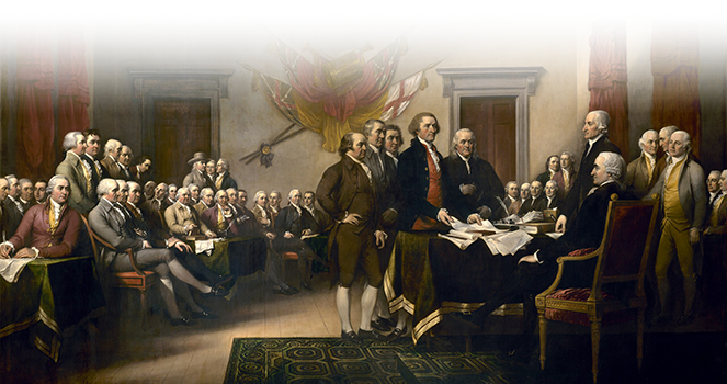
As the United States marks 250 years of independence, Fort Bend County proudly reflects on its own place in the nation’s unfolding story.
This milestone offers an opportunity to explore the histories that define our county — Indigenous homelands, the Old 300 settlers, the evolution of sugar and agriculture, the legacy of freedom colonies, immigration from around the world, and the contributions of generations who built, transformed, and enriched this region. Fort Bend’s story is deeply intertwined with the broader American narrative of struggle, innovation, community, and hope.
Here’s to a quarter-millennium of the American journey — and to Fort Bend County’s enduring role within it.
Essay Contest
Read the four award-winning entries celebrating Fort Bend County’s place in America’s story.


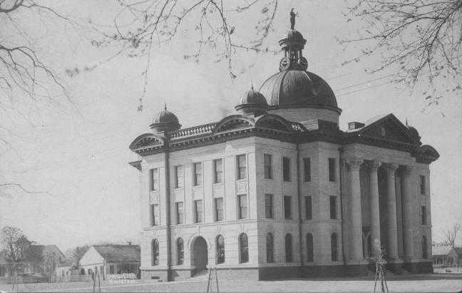
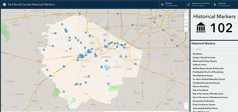
Fort Bend County Historical Marker Interactive Map: Find history all around you!
Livestream has concluded.
7th Grade Essay Topic:
The Struggle for Independence – Compare and contrast one of the following elements in the struggle for independence of the United States with the Republic of Texas:
Students should include specific examples of dates, places, individuals, and events that represent or reflect the student’s point of view with respect to the chosen topic.
7th Grade Essay Resources
The following are some suggested resources for the start of student’s research into the topics. It is expected that the student will conduct his/her own independent research beyond these resources. For additional resources please visit the George Memorial Library, your local Fort Bend County Library Branch, your school library and the Fort Bend Museum.
George Washington vs. Sam Houston:
George Washington [HTML]
History.com - George Washington [HTML]
The White House Historical Association-George Washington [HTML]
Sam Houston [HTML]
Sam Houston: A Legacy of Leadership in Texas History [HTML]
Preamble to US Constitution vs. Preamble to Texas Constitution:
The Preamble [PDF]
The Stylistic Artistry of the Declaration of Independence [HTML]
Texas State Library-Texas Declaration of Independence [HTML]
Bullock Museum-Texas Declaration of independence [HTML]
Causes of US Revolution vs. Causes of Texas War of Independence:
American Revolutionary War [HTML]
History.com - American Revolution Causes [HTML]
Events Leading to the American Revolution [HTML]
The Texas Revolution: Key Events and Impact [HTML]
Texas Revolution [HTML]
4th Grade Essay Topic:
Symbols of Freedom – Compare and contrast the history and meaning of one of the following symbols of the United States and Texas:
Essays should include information about when the symbol was created and adopted, what the words or elements of the symbol mean, and how the symbol has changed over time, if applicable.
4th Grade Essay Resources
The following are some suggested resources for the start of student’s research into the topics. It is expected that the student will conduct his/her own independent research beyond these resources. For additional resources please visit the George Memorial Library, your local Fort Bend County Library Branch, your school library and the Fort Bend Museum.
“Stars and Stripes” vs. “Lone Star”:
The History of Texas Flags: From Six Flags Over Texas to the Lone Star Flag [HTML]
The Texas State Flag – The Full History of the Lone Star Texas Flag [HTML]
Origin of the Lone Star Flag [HTML]
Flag of the United States [HTML]
The History of the American Flag [HTML]
“Star Spangled Banner” vs. “Texas, Our Texas”:
The Star-Spangled Banner [HTML]
History.com - The Star-Spangled Banner [HTML]
Texas, Our Texas [HTML]
Texas State Song: History and Significance [HTML]
How did ‘Texas, Our Texas’ become the official state song? [HTML]
U.S. Pledge of Allegiance vs. Texas Pledge of Allegiance:
Pledge of Allegiance [HTML]
The Pledge of Allegiance [HTML]
Contest Rules:
The contest is open to all 4th and 7th grade students that live or attend school in Fort Bend County.
Essays should be created using 12 point type in Times New Roman font.
Essays should be submitted in pdf format via email to: HistoricalCommission@fortbendcountytx.gov
Essays must be received by 5:00 pm on October 31, 2025
4th Grade Essays should be between 500 – 750 words (2-3 pages)
7th Grade Essays should be between 750 – 1000 words (3-4 pages)
All essays must contain a bibliography with at least 4 references, at least 2 of which are primary. The bibliography is not part of the word count.
All essays must contain a title page with the name of the student, the title of the essay, and the name of the school, or home address if homeschooled. Please also include the name and contact information (email or telephone number) for a parent or guardian. The title page is not part of the word count.
Essays may also contain one page of images, photographs, or original art related to the research topic, including image citations or descriptions.
[PDF]
[PDF]
Download Event [PDF]