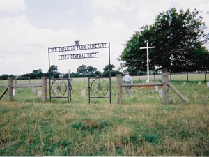
Brown Cemetery

Main Name: Thomas Cemetery, Faithe | FB-C076

Alternate Names:

  • Baptist Hill Cemetery
  • Brown Cemetery
  • Dave Fields Cemetery
  • Fate Thomas Cemetery
  • Fayette Thomas Cemetery
  • Fields Cemetery

Access: Public

Location: Collins Rd, Richmond

NAD83 Coordinates: 29 35.235 N, 95 46.325 W

Map Coordinates: 29.587250, -95.772083


View Thomas Cemetery, Faithe - FB-C076 in a larger map

Brown - Beard Cemetery | FB-C068

Photo Taken Date: 2009

 Brown - Beard Cemetery | FB-C068

Main Name: Brown - Beard Cemetery | FB-C068

Alternate Names:

  • Big Creek Cemetery
  • Cummings Road Cemetery
  • Pentecost Graveyard

Access: Cemetery access is via PRIVATE property. Permission from the land owner MUST be obtained prior to visiting the cemetery.

Location: Cummings Road, Damon

NAD83 Coordinates: 29 24.204 N, 95 38.396 W

Map Coordinates: 29.403400, -95.639933

Status and Other Information: The cemetery status is active and it has a Historical Marker. The cemetery is not affiliated with any organizations and the ethnicity is primarily Anglo. The size of the cemetery is 1.32 acres. The number of known burials is 62 and the date of the earliest burial is 09/17/1941.

History: Brown - Beard Cemetery | FB-C068 [PDF]


View Brown - Beard Cemetery - FB-C068 in a larger map

Broussard Grave, Claude Jr. | FB-C046

Photo Taken Date: 2011

Broussard Grave,  Claude Jr. | FB-C046

Main Name: Broussard Grave, Claude Jr. | FB-C046

Alternate Names:

  • Broussard Grave

Access: Public

Location: Just outside the Duke Cemetery

NAD83 Coordinates: 29 29.648 N, 95 29.637 W

Map Coordinates: 29.494133, -95.493950


View Broussard Grave, Claude Jr. - FB-C046 in a larger map


Broussard Grave

Photo Taken Date: 2011

Broussard Grave,  Claude Jr. | FB-C046

Main Name: Broussard Grave, Claude Jr. | FB-C046

Alternate Names:

  • Broussard Grave

Access: Public

Location: Just outside the Duke Cemetery

NAD83 Coordinates: 29 29.648 N, 95 29.637 W

Map Coordinates: 29.494133, -95.493950


View Broussard Grave, Claude Jr. - FB-C046 in a larger map


Briscoe Family Cemetery | FB-C045

Main Name: Briscoe Family Cemetery | FB-C045

Alternate Names: None

Access: Cemetery access is via PRIVATE property.  Permission from the land owner MUST be obtained prior to visiting the cemetery.

Location: Near FM723, Rosenberg

NAD83 Coordinates: 29 38.912 N, 95 48.831 W

Map Coordinates: 29.648537, -95.813851

Status and Other Information: The cemetery status is active.  The cemetery is not affiliated with any organizations and the ethnicity is primarily Anglo.  The size of the cemetery is 1.053 acre.  The number of known burials is 38 and the date of the earliest burial is 08/28/1838.


View Briscoe Family Cemetery - FB-C045 in a larger map


Brick Church Cemetery | FB-C037

Main Name: Brick Church Cemetery | FB-C037

Alternate Names: None

Access: Cemetery access is via PRIVATE property. Permission from the land owner MUST be obtained prior to visiting the cemetery.

Location: 21410 Morton Road, Richmond

NAD83 Coordinates: 29 39.968 N, 95 45.213 W

Map Coordinates: 29.666133, -95.753550

Status and Other Information: The cemetery status is inactive.  The cemetery is not affiliated with any organizations and the ethnicity is primarily Afro-American.  The size of the cemetery is unknown.  The number of known burials is 18 and the date of the earliest burial is 03/26/1874.


View Brick Church Cemetery - FB-C037 in a larger map


Brazos River Grave | FB-C060

Main Name: Brazos River Grave | FB-C060

Alternate Names: None

Access: Cemetery access is via PRIVATE property.  Permission from the land owner MUST be obtained prior to visiting the cemetery.

Location: Thompsons

NAD83 Coordinates: 29 30.476 N, 95 34.702 W

Map Coordinates: 29.507933, -95.578367

Status and Other Information: The cemetery status is inactive.  The cemetery is not affiliated with any organizations and has no primary ethnicity.  The size of the cemetery is unknown.  The number of known burials is 3 the date of the earliest burial is ca 1800.


View Brazos River Grave - FB-C060 in a larger map


Branch Cemetery | FB-C022

Main Name: Branch Cemetery | FB-C022

Alternate Name: None

Access: Public

NAD83 Coordinates: 29 31.663 N, 95 32.032 W

Map Coordinates: 29.527717, -95.533867

Status and Other Information: The cemetery status is inactive. The size of the cemetery is 0.2 acre. The number of known burials is approximately 15 and the date of the earliest burial is unknown.


View Branch Cemetery - FB-C022 in a larger map


Border Camp Cemetery | FB-C055

Main Name: Border Camp Cemetery | FB-C055

Alternate Names:

  • Boarding Cemetery
  • Border Cemetery

Access: Public

Location: Not Located. Number assigned by Texas State Historical Commission.

NAD83 Coordinates:

Map Coordinates:


Boone Family Cemetery

Main Name: Snake Creek Cemetery | FB-C014

Alternate Names:

  • Boone Cemetery 
  • Boone Family Cemetery
  • Shiloh Cemetery

Access: Cemetery access is via PRIVATE property. Permission from the land owner MUST be obtained prior to visiting the cemetery.

Location: Dale Dodge Ln, Needville

NAD83 Coordinates: 29 21.622 N, 95 55.098 W

Map Coordinates: 29.360367, -95.918300

Status and Other Information: The cemetery status is active and it has a Historical Marker. The cemetery is not affiliated with any organizations and the ethnicity is primarily Anglo. The size of the cemetery is unknown. The number of known burials is 91 and the date of the earliest burial is 1858.


View Snake Creek Cemetery - FB-C014 in a larger map


Subscribe to Historical Commission